blah blah blah
Mt. Hale
Length: 4.4 miles out-and-backDifficulty (click for info): Hard
Elevation Gain: 2290 feet
Rating (click for info): 6/10
Elevation: 4064'
Prominence: 629'
Driving Directions:
Trailhead and parking area are on Zealand Road in Bethlehem, NH. (Seasonal road - check TrailsNH to verify gate status). Zealand Road leaves the west side of Rt. 302 2.2 miles east of Rt. 3. The parking area is 2.5 miles down the road, on the right. Click here for a Google map.
About the Hike:
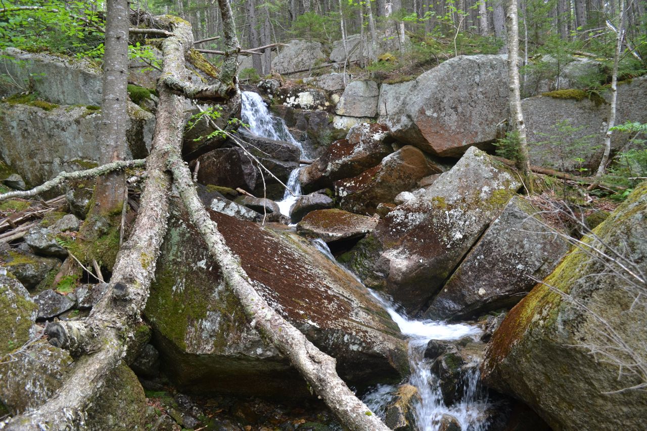
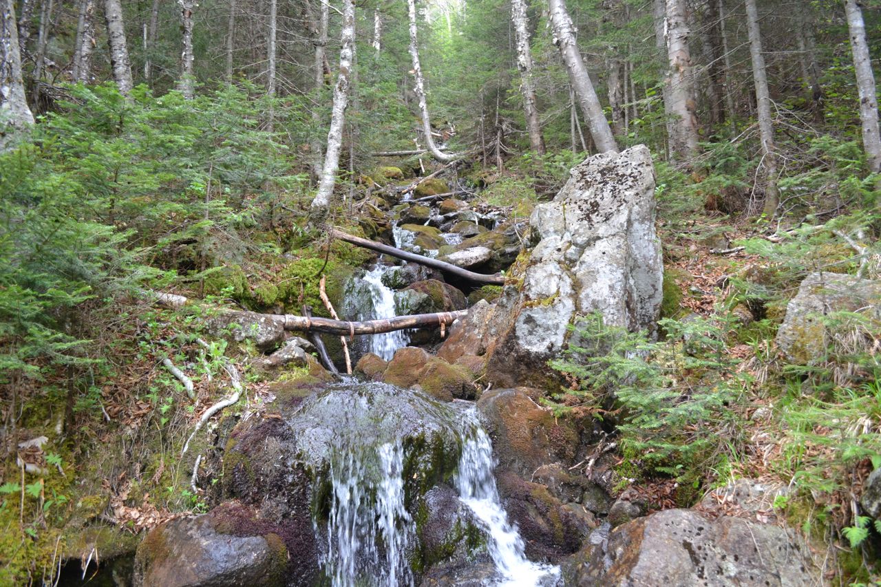
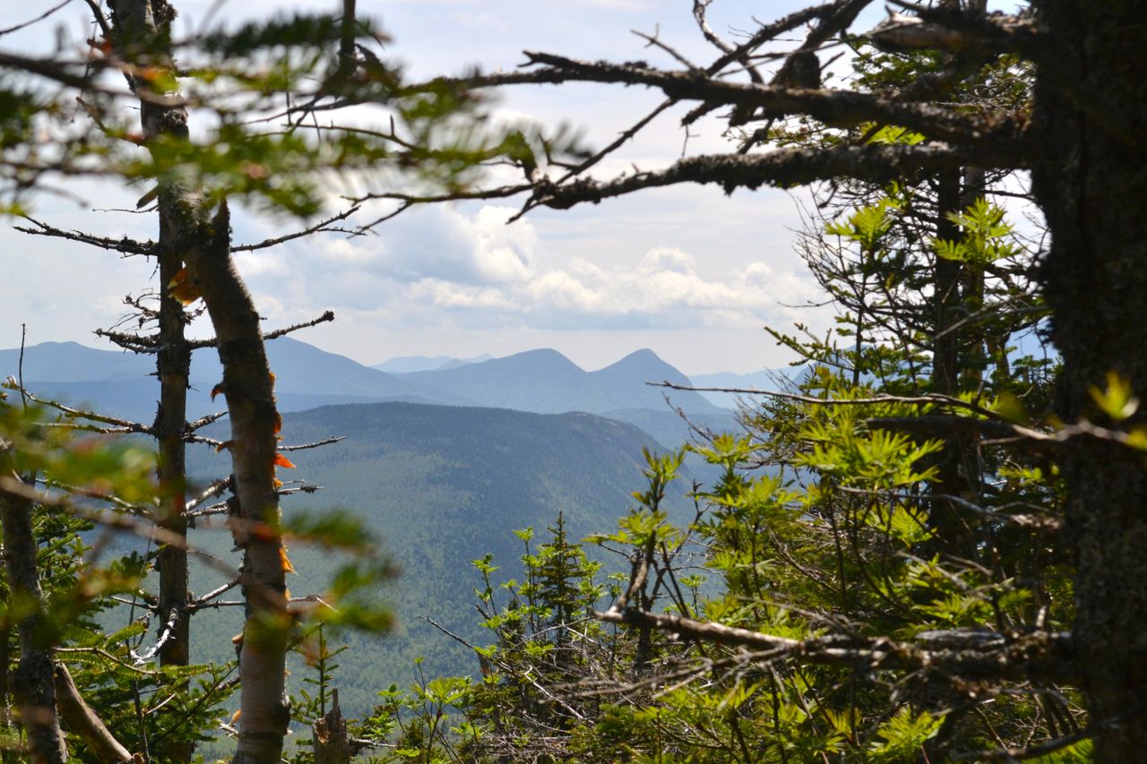
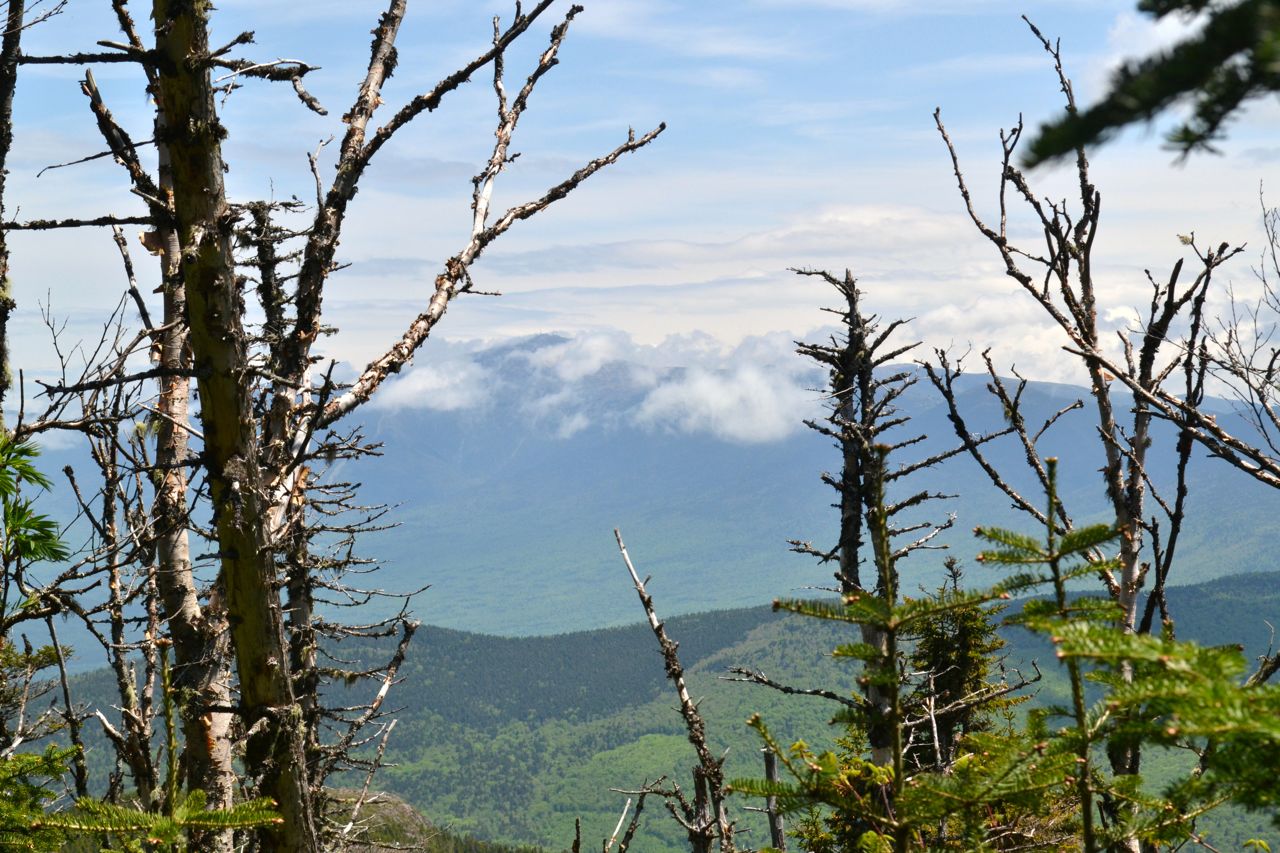
Mt. Hale is the leader of the Little River Range, a ridge extending north from Zealand Mountain in the Twin Range. It's a small but distinct cluster of peaks that's most famous for the Sugarloaf Mountains, a pair of ledgy domes with great views that rise above the stoplight in Twin Mountain. Until 1972, the summit fire tower provided spectacular views in all directions; now, the only views to be found on the mountain are through the trees. It is the only 4000-footer with no scenic views to be seen. For this reason, many 4000-footer climbers choose to save this hike for a day with less-than-perfect weather. On the hike, which is the briefest of any to a 4000-footer, you will see cascades, brooks, and pretty birch forests, as well as very minor views from a blowdown patch near the summit.
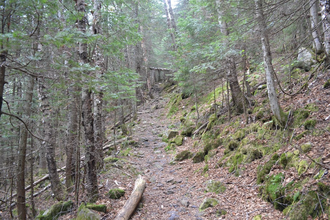
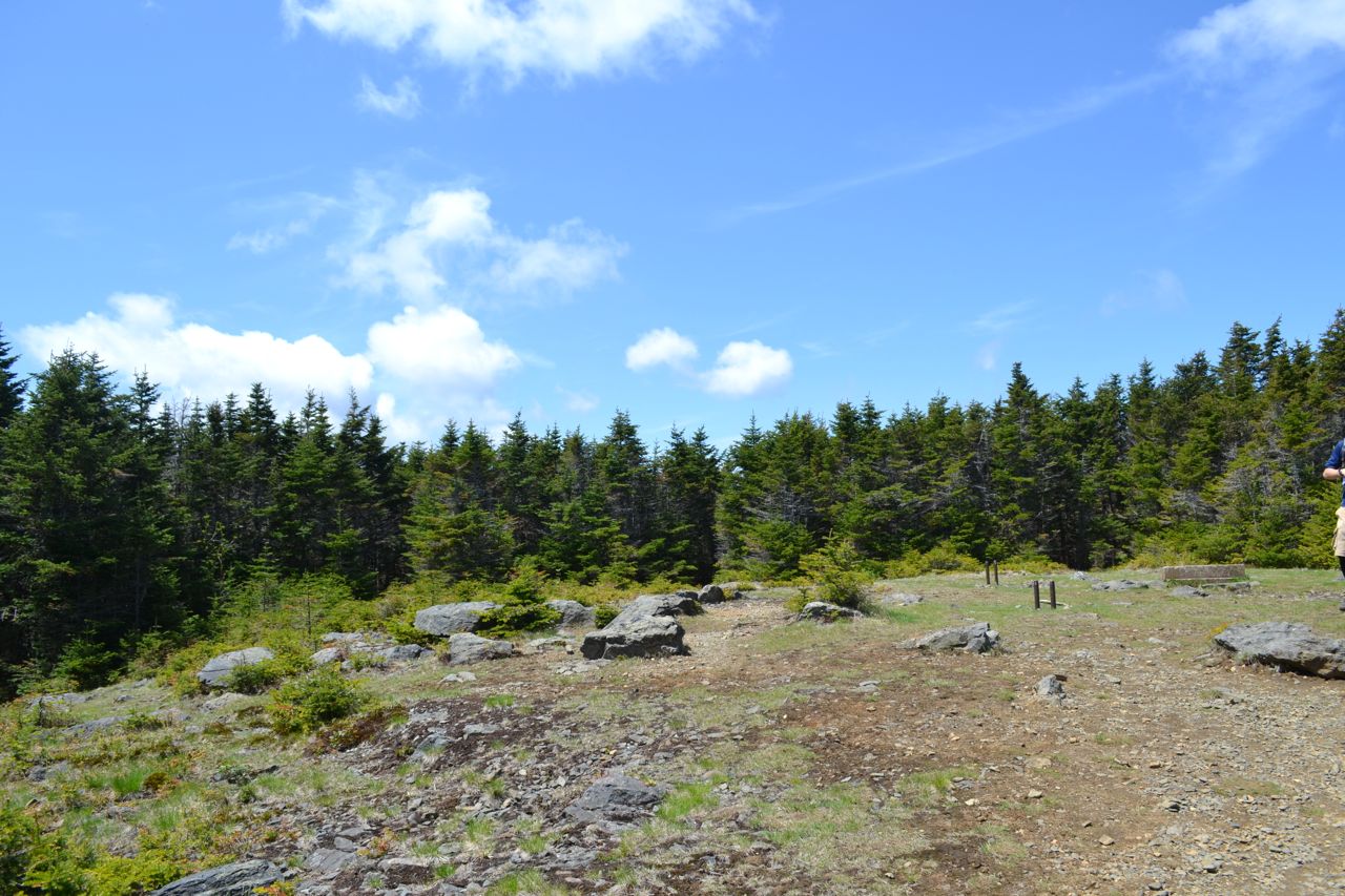
The hike begins on the Hale Brook Trail. The trail heads off into the forest, very quickly crossing a bridge over a small brook and beginning a stiff climb. It crosses a cross-country ski trail after 0.1 miles and continues up at a steady pace. It then begins a moderate climb and approaches a narrow ridge where logging activity occured on the right. It slides across the top of the ridge and approaches Hale Brook. A herd path leads to the base of a small cascade. The trail then crosses the brook at 0.7 miles from the parking area and continues its climb away from it. Eventually, the trail grade eases as it traverses across the steep slope rising from Hale Brook. Fine birch stands are found here, as well as glimpses through the trees up toward Mt. Hale's east peak. Half a mile from the first crossing, the trail recrosses Hale Brook, now a smaller, cascading stream flowing steeply downhill. The easy climb continues toward much steeper terrain, which the trail ascends with four switchbacks. The forest becomes lush and mossy. After 0.4 miles in the switchbacks, the trail crosses a few smaller streams, then enters a more open forest and turns right to begin the final climb to the summit. 0.2 miles takes you to another right bend, and then it's another 0.2 to the summit. This last section is where you will find slight views. By peeking through small openings in the dead trees around the blowdowns, you can glimpse views of the Willey Range and Zealand and Carrigain Notches. The best view is looking back over the trail to Mt. Washington. The summit of Mt. Hale is a large, grassy clearing with a huge cairn and a few cement footings and tiedowns from the fire tower.
Printable directions page